Catalog Archive
Auction 102, Lot 190

"City of Washington [together with] Washington and Georgetown", Various

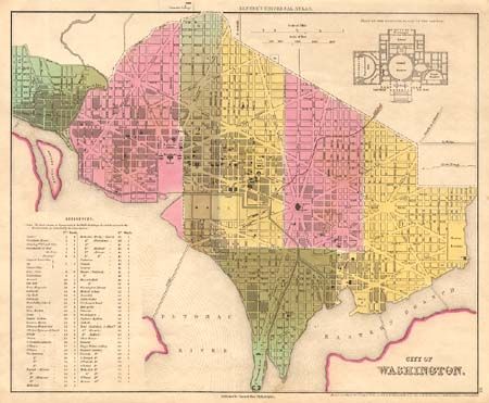
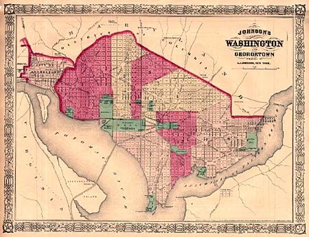
Subject: District of Columbia

Period: 1836-68 (dated)

Publication:

Color: Hand Color

Size:
See Description
Download High Resolution Image
(or just click on image to launch the Zoom viewer)

"City of Washington" is from Tanner's Universal Atlas, 1836 (14.2 x 11.5"). It is a fine plan of the city divided into six wards and noting the major governmental buildings. A floor plan of the Capital is included along with a table key. "Washington and Georgetown" is from Johnson's Illustrated Family Atlas, 1868 (17 x 12.9"). It provides a great comparison with Tanner's plan showing the development of the city.

References:

Condition:

First is very good, second a bit brittle with a couple of tears stabilized with archival tape.

Estimate: $300 - $350

Sold for: $220

Closed on 3/5/2003

Archived