Catalog Archive
Auction 102, Lot 173

"Map of a Survey and Reconnaissance of the Vicinity of the Mouth of the Rio Gila", Whipple, Amiel Weekes

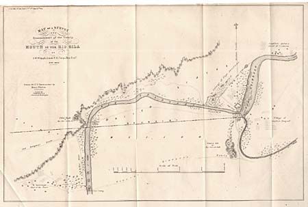
Subject: Southwestern United States - Arizona and Mexico

Period: 1849 (dated)

Publication: Senate Doc. #34, 31st Cong. 1st Sess.

Color: Black & White

Size:
16.5 x 11 inches
41.9 x 27.9 cm
Download High Resolution Image
(or just click on image to launch the Zoom viewer)

This map illustrates a critical aspect of the Mexican Boundary Survey (following the Treaty of Guadeloupe Hidalgo), with the determination of an agreed upon point, as the middle of the Rio Gila where it enters the Colorado, to anchor the boundary line in the east. Shows the villages of Captain Pasqual, Capt. Anastasio, and Captain Anton in the vicinity of Yuma. Also shows the Old Emigrant Route and General Kearney's Route. An important map and companion to the map of the Southernmost point of the Port of San Diego by Emory.

References: Wheat (TMW) #653.

Condition: A+

Folding, as issued.

Estimate: $120 - $150

Sold for: $90

Closed on 3/5/2003

Archived