Catalog Archive
Auction 101, Lot 50

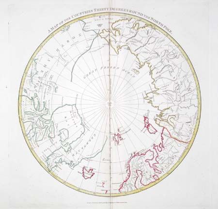
"A Map of the Countries Thirty Degrees Round the North Pole", Longman Co.

Subject: North Pole

Period: 1808 (dated)

Publication: Atlas to Cruttwell's Gazetteer

Color: Hand Color

Size:
13.5 x 14.5 inches
34.3 x 36.8 cm
Download High Resolution Image
(or just click on image to launch the Zoom viewer)

Shows the extent of polar geographical knowledge in a hemispherical map. The northern shoreline of North America is unknown and left mostly blank. Greenland is shown connected to the continent across Baffin's Bay. In north central Canada a small bit of ocean is shown with the note "1772". Includes notes of fresh water, and another between Siberia and Alaska that indicates the ice extends from continent to continent.

References:

Condition: B

Fine impression and nice color on sheet with wide margins and 1805 watermark. Lightly toned along centerfold, else very good.

Estimate: $150 - $200

Sold for: $85

Closed on 12/4/2002

Archived