Catalog Archive
Auction 101, Lot 475

"A Chart of the Pacific Ocean from the Equinoctial to the Latitude of 39 1/2 d. No.", Anson, George

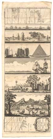
Subject: Pacific Ocean

Period: 1748 (published)

Publication: Universal Magazine

Color: Black & White

Size:
20.3 x 7.5 inches
51.6 x 19.1 cm
Download High Resolution Image
(or just click on image to launch the Zoom viewer)

This is a very unusual chart describing the voyage of Commodore Anson's Pacific explorations. The plate incorporates six views into the body of the map so that only the extreme western (Japan and the Philippines) and eastern (Mexico) sections of the map are retained. A) View of the squadron under full sail off the coast of Tierra del Fuego; B) Anson's attack on the town of Paita; C) Natives ships captured off the Ladrone Islands; D) The capture of the Manila Galeon by the Centurion off Cape Spirita Santo (for which the expedition is renowned); E) View of a watering place on the island of Tinian; F) A prospect of the island of Juan Fernandes including figures of sea lions. All together a fascinating compilation of this extraordinary voyage.

References: Jolly UNIV-13.

Condition: A+

Estimate: $275 - $325

Sold for: $200

Closed on 12/4/2002

Archived