Catalog Archive
Auction 101, Lot 229

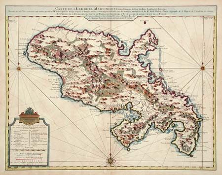
"Carte de l'Isle de la Martinique Colonie Francoise de l'une des Isles Antilles de l'Amerique…", Covens & Mortier
Subject: Martinique

Period: 1759 (circa)

Publication:

Color: Hand Color

Size:
23.3 x 18 inches
59.2 x 45.7 cm
Download High Resolution Image
(or just click on image to launch the Zoom viewer)

A very well executed plan of the island after Delisle. Excellent detail throughout includes realistic depictions of bays, mountains, islets, lagoons, forests, etc., which are combined with details of human development of the flourishing colony. Each town, plantation house, windmill, watermill, and sugar works is indicated, as well as gun emplacements, fortifications, anchorages, and government houses. A very handsome chart with two decorative compass roses and rhumb lines.

References:

Condition: B

Very crisp impression and nice coloring. A little scattered toning, else very good.

Estimate: $400 - $450

Sold for: $350

Closed on 12/4/2002

Archived