Catalog Archive
Auction 101, Lot 143

"Map of Military Road From Fort Walla Walla on the Columbia to Fort Benton on the Missouri", U.S. War Department

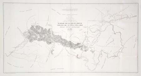
Subject: United States - Northwestern

Period: 1863 (circa)

Publication: Sen. Doc. #43, 37th Cong.. 3rd Session

Color: Black & White

Size:
33.8 x 17.5 inches
85.9 x 44.5 cm
Download High Resolution Image
(or just click on image to launch the Zoom viewer)

Interesting map covering the country from about the 49th to the 45th parallel, so the Columbia River is shown as far up as the confluence with Clark's Fort. The Snake River is shown only as far as Lewiston, but Clark's Fork is shown in its entirety, as are Flathead River and Lake. The map provides great detail of the mining districts, numerous wagon roads, Indian Reservations, battlefields, forts, etc. This is the general map drawn by Freyhold for Captain John Mullen's important report, which appeared (and was part of the lobbying effort) during the congressional debates that resulted in the establishment of Idaho Territory.

References: Wheat [TMW] #1080; Wagner-Camp #393.

Condition: A

Very faint toning along outer fold, still very good. Backed with light Japanese tissue.

Estimate: $250 - $300

Sold for: $275

Closed on 12/4/2002

Archived