Catalog Archive
Auction 101, Lot 139

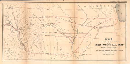
"Map showing the Eastern Portion of the Union Pacific Rail Road and its Connections…", U.S. Government

Subject: United States - Central Midwest

Period: 1866

Publication:

Color: Printed Color

Size:
22 x 10.4 inches
55.9 x 26.4 cm
Download High Resolution Image
(or just click on image to launch the Zoom viewer)

Historical map created to accompany a report by Springer Harbaugh, Sec. of the Interior. Covers the region between Chicago to Omaha, as far south as Macon City, Missouri and north to Ft. Dodge, Iowa. Shows numerous railroads in red. A great map for the railroad enthusiast.

References:

Condition: B

Issued folding, now backed with archival tissue. A little more toning along some folds, short fold split..

Estimate: $100 - $120

Sold for: $60

Closed on 12/4/2002

Archived