Catalog Archive
Auction 101, Lot 107

"A New Map of Nova Scotia, and Cape Breton Island with the adjacent parts of New England and Canada…", Jefferys, Thomas

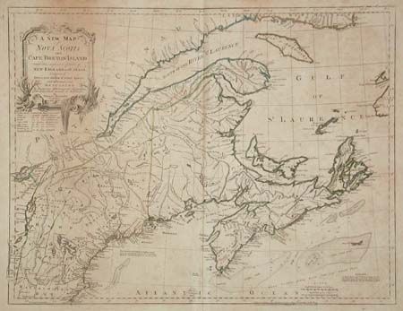
Subject: Colonial New England and Canada

Period: 1775 (dated)

Publication:

Color: Hand Color

Size:
24.1 x 18.5 inches
61.2 x 47 cm
Download High Resolution Image
(or just click on image to launch the Zoom viewer)

Fourth state of this long-lived map, first issued in 1755. The map includes New England as far south as Boston, the St. Lawrence River up to Montreal, and as far north as the southern coastline of Labrador. The boundary between Nova Scotia and New England begins at the Penobscot River and then along a dotted line straight north, roughly according to the Treaty of Versailles. It provides an excellent view of the region with detail of the settlements, roads, forts, Indian nations and fishing banks. Decorative title cartouche. Published by Sayer and Bennett, circa 1783.

References: Kershaw #745; McCorkle #775.8; Stevens & Tree #66-j; Sellers and Van EE #309.

Condition: B

Toned with scattered foxing.

Estimate: $300 - $350

Sold for: $275

Closed on 12/4/2002

Archived