Catalog Archive
Auction 100, Lot 457
"Mar del Zur Hispanis mare Pacificum", Jansson, Jan
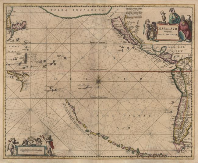
Subject: Pacific Ocean
Period: 1657 (circa)
Publication:
Color: Hand Color
Size:
21.5 x 17.2 inches
54.6 x 43.7 cm
Download High Resolution Image
(or just click on image to launch the Zoom viewer)
(or just click on image to launch the Zoom viewer)