Catalog Archive
Auction 100, Lot 333

"Lotharingia Ducatus", Mercator, Gerard
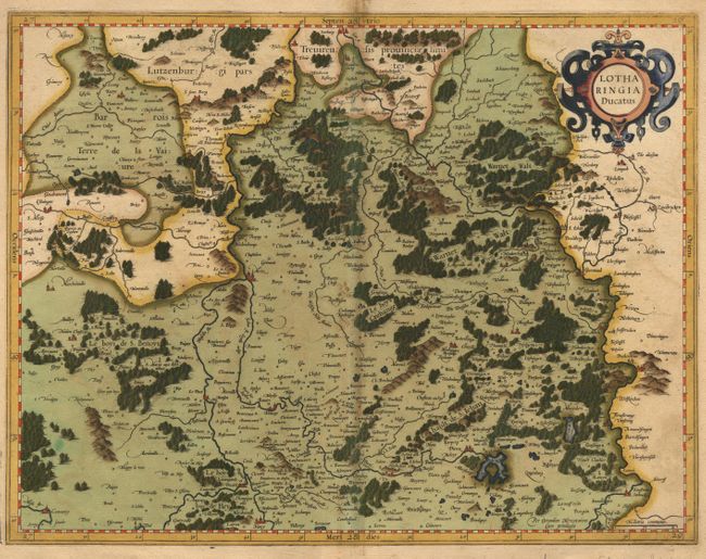
Subject: France

Period: 1600 (published)

Publication: Atlas

Color: Hand Color

Size:
18.5 x 14 inches
47 x 35.6 cm
Download High Resolution Image
(or just click on image to launch the Zoom viewer)

Pair of maps covering the region of Lorraine with copious detail. The northern map contains the strapwork title cartouche, while the southern map is simply embellished with the scale of miles. The maps are fully engraved to depict the forests and mountains and major cities are shown as tiny castles.

References: Vander der Krogt (Atlantes) 4251:1A & 4252:1A.

Condition: B

Full original color. Toning along centerfolds.

Estimate: $325 - $400

Sold for: $250

Closed on 9/12/2002

Archived