Catalog Archive
Auction 100, Lot 269
"A New Map or Chart of the Western or Atlantic Ocean, with part of Europe Africa & America: Shewing the Course of the Galleons, Flota &c. to and from the West Indies", Bowen, Emanuel
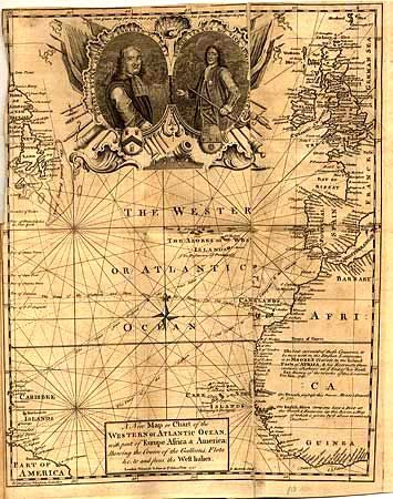
Subject: Atlantic
Period: 1740 (published)
Publication: Gentleman's Magazine
Color: Black & White
Size:
10.8 x 13.8 inches
27.4 x 35.1 cm
Download High Resolution Image
(or just click on image to launch the Zoom viewer)
(or just click on image to launch the Zoom viewer)