Catalog Archive
Auction 100, Lot 209

"[Lot of 3 Maps]", U.S. Corps of Engineers

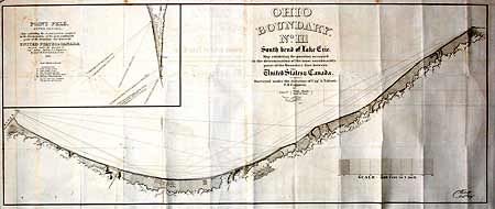
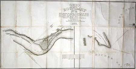
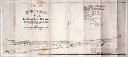
Subject: Ohio - Michigan Border Dispute

Period: 1835 (dated)

Publication: HR Doc 54, 24th Cong, 1st Sess..

Color: Black & White

Size:
See Description
Download High Resolution Image
(or just click on image to launch the Zoom viewer)

These three maps are related to the boundary dispute between Michigan and Ohio wherein Ohio refused to allow Michigan's statehood admission until the matter was resolved in Ohio's favor. Includes "Ohio Boundary No. 1. South bend of Lake Michigan" 29 x 12.5"; "Ohio Boundary No. 2 Map exhibiting the positions occupied on the Maumee Bay and River…" 36.8 x 18.5"; "Ohio Boundary No. III South bend of Lake Erie" with large inset of Point Pele Upper Canada. 45.5 x 18.5". Robert E. Lee and William Hood surveyed two of the maps. Remarkable to see these three maps together.

References: Karpinski #684, 685, 686.

Condition: B

All are good impressions on sound paper. All with light scattered foxing or offsetting.

Estimate: $350 - $450

Sold for: $220

Closed on 9/12/2002

Archived