Catalog Archive
Auction 100, Lot 177

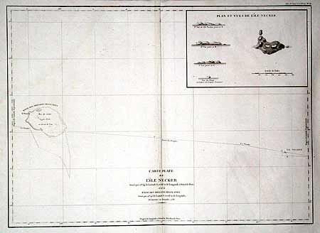
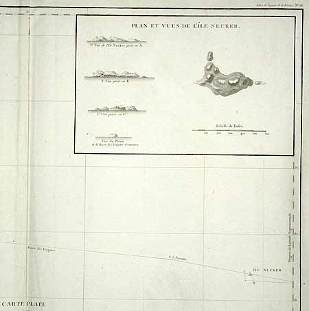
"Carte Plate de l'Ile Necker…", La Perouse, Comte Jean F. Galoup, de

Subject: Hawaii

Period: 1786 (dated)

Publication:

Color: Black & White

Size:
27 x 19.5 inches
68.6 x 49.5 cm
Download High Resolution Image
(or just click on image to launch the Zoom viewer)

Sea chart of the Pacific Ocean depicting La Perouse's route between Necker Island, a northern island in the Hawaiian Group, to French Frigate Shoal. La Perouse discovered Necker Island on November 4, 1786. This famous French navigator sailed within a third of a league of the island on his passage westward, noting the perpendicular cliffs, white with the droppings of birds, the absence of trees, and the violence of the sea, which made it impossible to land. He called it Ile Necker, in honor of Monsieur Jacques Necker, French Minister of Finance under Louis XVI. Includes a large inset: Plan et Vues de l'Ile Necker.

References:

Condition: B

Stains in side margins, well away from map. Small worm hole at centerfold, else very good.

Estimate: $230 - $250

Unsold

Closed on 9/12/2002

Archived