Catalog Archive
Auction 100, Lot 152
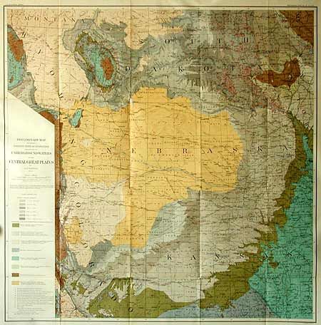
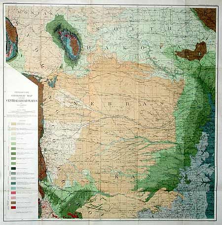
"Preliminary Map Showing Present State of Knowledge relating to Underground Waters in the Central Great Plains [together with] Preliminary Geologic Map of the Central Great Plains", U.S. Geographical Survey
1 of 2
Subject: United States - Midwest
Period: 1904 (dated)
Publication: Professional Paper No. 32.
Color: Printed Color
Size:
30 x 30 inches
76.2 x 76.2 cm
Download High Resolution Image
(or just click on image to launch the Zoom viewer)
(or just click on image to launch the Zoom viewer)