Catalog Archive
Auction 100, Lot 122

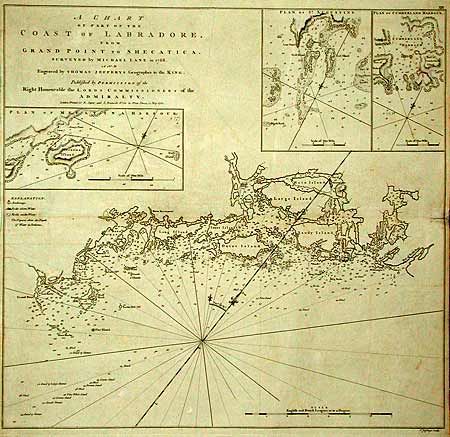
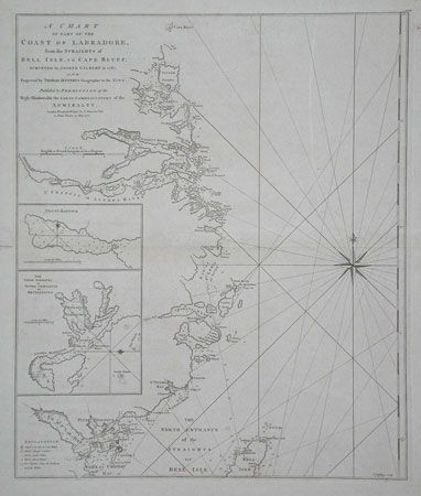
"[Lot of 2] A Chart of Part of the Coast of Labradore…", Jefferys, Thomas

Subject: Canada

Period: 1770 (dated)

Publication: The North American Pilot

Color: Black & White

Size:
20.5 x 19 inches
52.1 x 48.3 cm
Download High Resolution Image
(or just click on image to launch the Zoom viewer)

Pair of fine sea charts detailing the coast of Labrador. First, "A Chart of Part of the Coast of Labradore, from Grand Point to Shecatica Surveyed by Michael Lane in 1768" includes insets of Mecatina, St. Augustine and Cumberland. Second, "A Chart of part of the Coast of Labradore, from the Straights of Bell Isle, to Cape Bluff Surveyed by Joseph Gilbert in 1767" includes insets of Petty Harbour, and Sophia, Charlotte & Mecklenburg. Both with great detail typical of Jeffrey's charts. Large compass rose on second chart. Both published by Sayer and Bennett. Size given is approximate for each chart.

References: Phillips (A) #1209.

Condition: B

Faint offsetting. First with fold separation 1" into map. Second with repaired marginal fold separation not affecting map.

Estimate: $800 - $900

Unsold

Closed on 9/12/2002

Archived