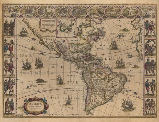
"Americae nova Tabula", Blaeu, Willem
Subject: Western Hemisphere
Period: 1635 (published)
Publication: Theatrum Orbis Terrarum
Color: Hand Color
Size:
21.8 x 16 inches
55.4 x 40.6 cm
This carte-a-figures map is a superb example of the fine art of decorative cartography with ships and sea monsters embellishing the map. Panels at sides, each with five portraits of figures of the native inhabitants of the two continents. Across the top are nine town plans including Mexico City, Havana, Cartegena, and Rio de Janeiro. This is one of the few maps of the Americas by this famous Dutch cartographer. The map itself is similar to Blaeu's wall map of 1608 with the additional discoveries of Henry Hudson and Tierra del Fuego with Le Maire Strait. This is the third state of the plate from a Latin edition with the coastline of Terra Australis Incognita deleted, but the name left behind.
References: Burden #189; Tooley (Amer) plt. 169.
Condition: A
Fine impression and original color. Professional repair of lower centerfold.