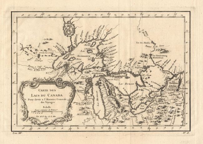
"Carte des Lacs du Canada Pour servir a l'Histoire Generale des Voyages", Bellin, Jacques Nicolas
Subject: Great Lakes
Period: 1757 (dated)
Publication: Prevost's Histoire Generale des Voyages
Color: Black & White
Size:
11.4 x 7.6 inches
29 x 19.3 cm
An excellent little map depicting the five Great Lakes. While this map uses the same title as Bellin's first map of the Great Lake, published in Charlevoix’s Histoire … in 1744, it has been updated with information from his similar map of 1755. Lakes Erie and Ontario are more accurately defined and the spurious islands in Lake Huron have been deleted. However, several large islands still remain in Lake Superior, including the entirely incorrect I. Philippeaux. The Michigan peninsula is still misshapen with the large mountain range down its middle. Ornate rococo title cartouche draped with ivy.
References: Kershaw #953; Portinaro & Knirsch, pl. 243.
Condition: A+
Clean, crisp impression with one very tiny spot, still fine.