Catalog Archive
Auction 94, Lot 144
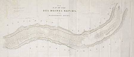
"Map of the Des Moines Rapids of the Mississippi River", U.S. Government
Subject: Illinois
Period: 1837 (published)
Publication: Ex Senate Doc. 139, 25th Cong., 2nd Session
Color: Black & White
Size:
48 x 21 inches
121.9 x 53.3 cm
Download High Resolution Image
(or just click on image to launch the Zoom viewer)
(or just click on image to launch the Zoom viewer)