Catalog Archive
Auction 93, Lot 160
"Scheeps Togt van Jamaica Gedaan na Panuco en Rio de las Palmas Aande Golf van Mexico Gelegen", Aa, Pieter van der
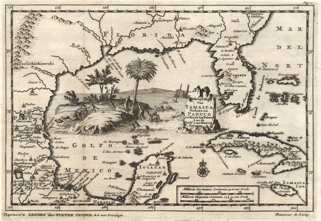
Subject: Gulf of Mexico and Caribbean
Period: 1710 (circa)
Publication:
Color: Black & White
Size:
9 x 6 inches
22.9 x 15.2 cm
Download High Resolution Image
(or just click on image to launch the Zoom viewer)
(or just click on image to launch the Zoom viewer)