Catalog Archive
Auction 93, Lot 102
"A Map of the Island of St. John in the Gulf of St. Laurence Divided Into Counties & Parishes and the Lots, as Granted by Government…", Sayer & Bennett
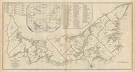
Subject: Canada
Period: 1775 (dated)
Publication: American Atlas
Color: Hand Color
Size:
27.5 x 14.2 inches
69.9 x 36.1 cm
Download High Resolution Image
(or just click on image to launch the Zoom viewer)
(or just click on image to launch the Zoom viewer)