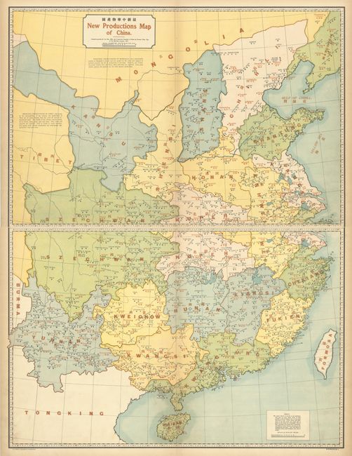
"[On 2 Sheets] New Productions Map of China",
Subject: China
Period: 1917 (dated)
Publication: The New Atlas and Commercial Gazetteer of China
Color: Printed Color
Size:
29 x 19.1 inches
73.7 x 48.5 cm
This large, dual-language map shows the natural resources and products made in various regions throughout China. The map is divided into provinces and shows major cities in red and the productions in each region in black. An incredible variety of items are produced, harvested and mined, including gold, silver, wool, silk, vinegar, salt, beans, timber, tobacco, cement, hides, nuts, indigo, and tea. A note is included explaining that cereals are not permitted to be exported. This two-sheet map was published by North-China Daily News & Herald, Ltd. in The New Atlas and Commercial Gazetteer of China, which was edited by John Edwin Dingle. The work was the most comprehensive, commercial atlas on China of its time, created for an English-speaking audience.
References: Rumsey #12042.
Condition: B+
Very light soiling in the image with minor toning along the edges of the sheet. The first image is a composite image - the map is in 2 separate sheets.