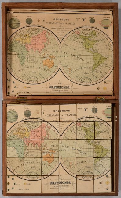
Interesting Cube-Style Puzzle Map
"[Set of 6 Puzzle Maps] ",
Subject: Cartographic Miscellany, Puzzle Maps, World & Continents
Period: 1890 (circa)
Publication:
Color: Printed Color
Size:
11 x 9.2 inches
27.9 x 23.4 cm
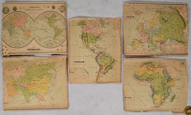
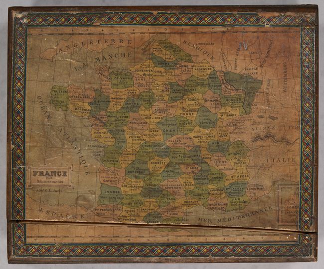
This interesting and complete puzzle consists of six maps - the world, Western Hemisphere, Europe, Asia, Africa and France. Published by Charles Verneau in Paris, the maps are on all sides of the 30 cubes. Getting the puzzles in the correct order is not easy and reminds one of working with a Rubik's Cube. The cubes neatly fit into the original wooden box that has a map of France with decorative border on top. The five other guide maps lay in the box and serve as an aid in solving the puzzles. The maps include:
A. Mappemonde en Deux Hemispheres
B. Amerique
C. Afrique
D. Asie
E. Europe
F. France par Departements
A cartographic curiosity that has survived well given its purpose as a game.
References:
Condition: B
The cube pieces are good with some light soiling and minor chipping of the paper along the edges. Guide maps are toned with edge chips and tears. The paper maps on the cubes as well as the guide maps have been trimmed down to fit the size of the cubes and box, resulting in some loss of border and image along the edges. Wooden box is intact though the hinge is loose and the box top has a crack running above the bottom edge. Metal clasp holding box closed is missing.