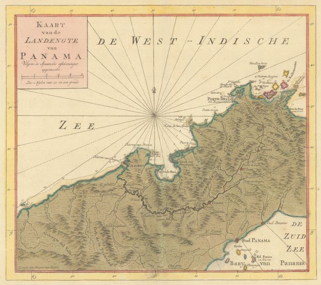
"Kaart van de Landengte van Panama, Volgens de Spaansche Aftekeninge Opgemaakt", Tirion, Isaac
Subject: Panama
Period: 1766 (circa)
Publication: Nieuwe en Beknopte Hand-Atlas
Color: Hand Color
Size:
12 x 10.6 inches
30.5 x 26.9 cm
Great map of central Panama showing Panama City in the southeast, Chagres in the northwest, and Portobelo in the northeast. Roads and the Chagres River connect them all. The road between Panama City and Portobelo passes though el Bujie, Boqueron, Pequeni, Sa. Juan, and Maria Enrique. Finely engraved with rhumb lines and a fleur-de-lis. Very detailed and fully engraved to show topographical information.
References: Shirley (BL Atlases) T.TIR-2a.
Condition: A
Excellent impression with full contemporary color that is lightly, pleasantly oxidized, on a sheet with wide margins and watermarks of a Strasbourg lily and "I. Villedary."