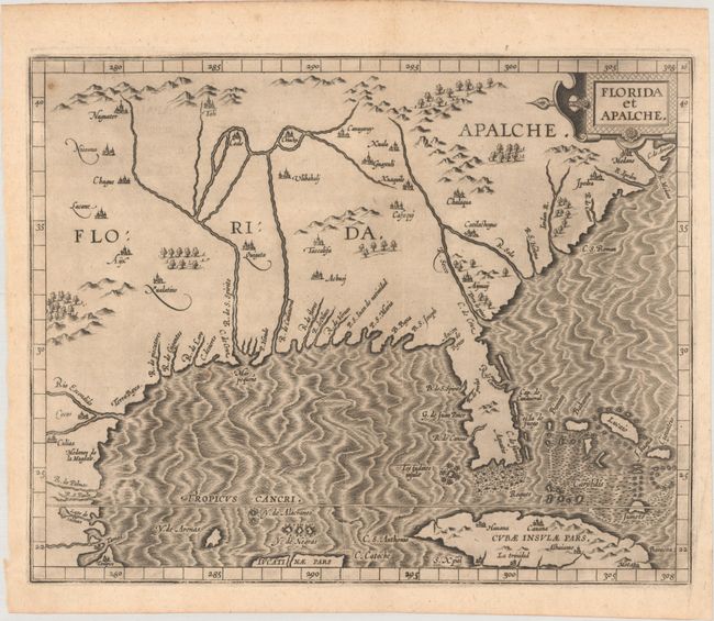
One of the Earliest Obtainable Maps of Florida & the Southeast
"Florida et Apalche", Wytfliet, Cornelis
Subject: Southern United States
Period: 1597 (published)
Publication: Descriptionis Ptolemaicae Augmentum
Color: Black & White
Size:
11.4 x 9.1 inches
29 x 23.1 cm
From the first printed atlas relating exclusively to America, this is one of only three 16th century printed maps of this region. Most of the information is derived from the Spanish explorations of Hernando de Soto, Cabeza de Vaca, and Moscoso. It is largely based on the Ortelius/Chaves map of 1584, but expanded to include parts of Cuba and the Bahamas and further north to show the territory of the legendary Apalche. The Florida peninsula is also presented in a more rectangular shape with a pronounced 'neck' at the top of the peninsula. The distorted Mississippi River is here called the Rio de Spirito Santo, the name given to it by the Spanish.
References: Burden #104; Cumming #18; Martin & Martin p.75, #6; Mickwitz & Miekkavaara #307-16; Shirley (BL Atlases) T.WYT-1a.
Condition: A
A dark impression on a watermarked sheet with two vertical printer's creases in the image and two small spots of foxing (the most visible of which is at top left).