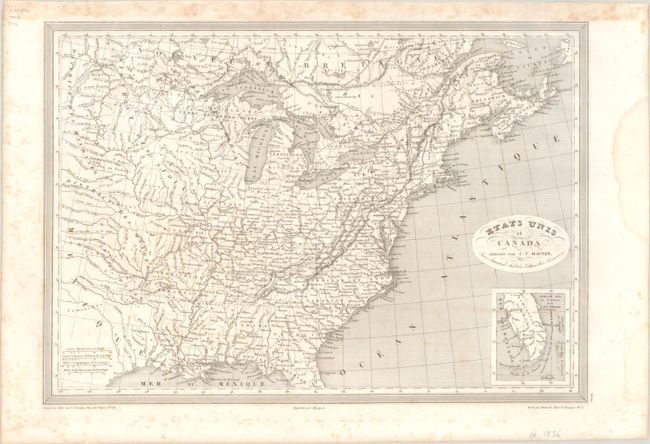
"Etats Unis et Canada ", Monin, Charles V.
Subject: Eastern United States & Canada, Texas
Period: 1830 (circa)
Publication:
Color: Black & White
Size:
18.1 x 12.6 inches
46 x 32 cm
A detailed steel engraved map presenting the eastern part of the U.S. and southeastern Canada. Missouri, Louisiana and Arkansas Territory are organized west of the Mississippi River, with the balance made up of districts controlled by various Indian Tribes. An early Texas under Mexican control takes in the region between the Brazos and Sabine rivers with only two settlements named (Brazoria and Nacogdoches). A small inset at bottom features a map of southern Florida including the Keys. The oval cartouche contains a calligraphy title. Drawn by Benard and engraved by Grenier.
References:
Condition: B
There is scattered foxing in the image and blank margins, toning in the top margin, and a few dampstains in the right margin.