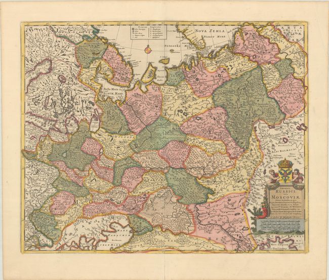
"Imperii Russici, sive Moscoviae, Status Generalis, in ejus Regna, Ducatus, Provincias, Populosq Subjacentes Divisus, et ex Tabula Spectatmi. Domini...", Wit, Frederick de
Subject: Russia in Europe
Period: 1706 (circa)
Publication:
Color: Hand Color
Size:
21.8 x 17.6 inches
55.4 x 44.7 cm
This striking map of Russia features good topographical detail and locates many towns and cities (including Moscow and Kiev), roads, rivers, lakes, and more. Portions of larger bodies of water appear, including the Gulf of Bothnia, Gulf of Finland, and Black and Caspian seas. Novaya Zemlya (Nova Zemla) is shown at top with an incomplete coastline. A key at top identifies the type of town or city. An ornate title cartouche with two putti, a cornucopia, a coat-of-arms, and a crown decorates the bottom right corner. In it, De Wit credits Nicolaes Witsen (1641-1717), the Dutch statesman, author, shipbuilding expert, and cartographer who traveled to Moscow in 1664-65, keeping a diary and collecting artifacts. He became fascinated about Russia and obtained all information available at the time on the subject, including maps, travelogues, manuscripts, and objects. This example was published in London by Christopher Browne.
References: Carhart #92.6.
Condition: B+
A sharp impression with full contemporary color on a clean, bright sheet. There are several short cracks that have been archivally repaired on verso, and a long centerfold separation at bottom that has also been archivally repaired.