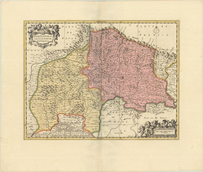
"Pamplonae, et Iacetanorum Episcopatus", Jansson/Valck & Schenk
Subject: Northeastern Spain
Period: 1700 (circa)
Publication:
Color: Hand Color
Size:
19 x 14.8 inches
48.3 x 37.6 cm
This map details the northeastern portion of Spain along the border of France, with Jaca just east of the center of the map. The map extends west as far as Sanguesa, south to Luna, and east to the Rio Ara. The mountainous terrain of this region is graphically depicted, and the map is embellished with two strapwork cartouches featuring putti with a Gunter's chain and measuring dividers. Petrus Schenk acquired the plate from Jansson's heirs and reissued the map with the imprint of his publishing partnership and with the addition of lines of latitude and longitude. Blank verso.
References: cf. Van der Krogt (Vol. I) #6220:1.
Condition: A+
A sharp impression with full contemporary color on a bright sheet with wide margins.