"Mappemonde en Deux Hemispheres",
Subject: World, Texas
Period: 1882 (dated)
Publication:
Color: Printed Color
Size:
35.9 x 26.7 inches
91.2 x 67.8 cm
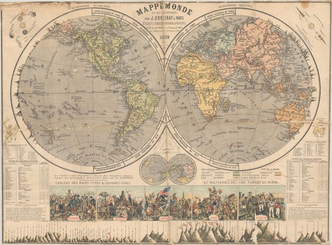
This elaborate double-hemisphere map of the world was drawn by J. Dosseray in Paris and lithographed by J.E. Goossens in Brussels. The map delineates the various countries of the world in red outline and the continents are color-coded to a table below indicating population. News must travel very slowly "across the pond," as Texas is still shown as a independent Republic despite the 1882 publication date! Along the edges of the hemispheres are the principal mountains which are numbered to table listings below. In the cusp are two small polar projection maps and a pair of celestial diagrams fill the top corners. The sheet is further decorated by a large illustration featuring the races and dress across the five continents, as well as a comparative chart of the principal mountains including several active volcanoes. We found only one other example of this map for sale in the last 30 years.
References:
Condition: C+
Issued folding and backed with old linen. There are numerous areas of small loss primarily along the folds as well as at top left. There is minor soiling and staining along the top border.