"Chart of the World Shewing the Tracks of the U.S. Exploring Expedition in 1838, 39, 40, 41 & 42", Wilkes, Charles
Subject: World
Period: 1845 (circa)
Publication: Narrative of the United States Exploring Expedition…
Color: Hand Color
Size:
33.9 x 23.4 inches
86.1 x 59.4 cm
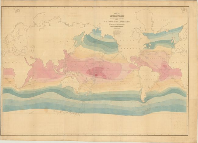
This large map of the world is drawn on Mercator's Projection and provides a detailed record of the U.S. Exploring Expedition's journey around the world. Led by Charles Wilkes, the Exploring Expedition's most notable accomplishment was establishing Antarctica as a continent, and this map is the first to show a significant portion of the Antarctic coastline based on actual observation. The mapped portion is located directly below Australia and New Zealand and is known today as Wilkes Land. In addition to the tracks of the six ships involved in the expedition, the chart notes ocean currents, wind direction, and colored isothermal lines (representing ocean temperature in 5 degree bands). Published in the uncommon larger edition of Wilkes' work.
References: Howes #W-414; Sabin #103994.
Condition: B
Issued folding with light toning, minor foxing and offsetting, and some staining at bottom. Trimmed to the border at left by the binder with a 3" edge tear that has been closed on verso with archival material.