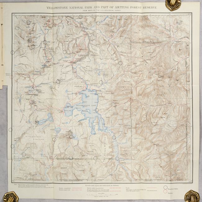
"[Map in Report] Yellowstone National Park and Part of Abutting Forest Reserve from Maps by the U.S. Geological Survey [in] Report of the Acting Superintendent of Yellowstone National Park", U.S. Geological Survey (USGS)
Subject: Yellowstone, Wyoming
Period: 1904 (published)
Publication:
Color: Printed Color
Size:
19.9 x 17.9 inches
50.5 x 45.5 cm
This beautifully-colored topographical map was issued by the Park Superintendent after maps by the U.S. Geological Survey. It shows the entire park in great detail at a scale of four miles per inch. Legend identifies ranger stations, snowshoe cabins, existing roads, roads under construction, trails and more. It locates the remote Shoshone, Lewis and Heart Lakes; names the Upper, Shoshone, Gibbon, and Heart Lake Geyser Basins, Mud Geysers, Mammoth Hot Springs and more. There is terrific detail of topography with contour intervals at 100 feet, watershed and numerous features. The map is accompanied by the 24-page report which includes 7 single-page photographic plates.
References:
Condition: A
The folding map is clean and bright. Disbound text has a hint of pleasant light toning.