NO RESERVE
"[Lot of 2] Maryland and Delaware [and] The Century Atlas. Maryland and Delaware",
Subject: Maryland, Delaware & Washington, D.C.
Period: 1897-1907 (circa)
Publication:
Color: Printed Color
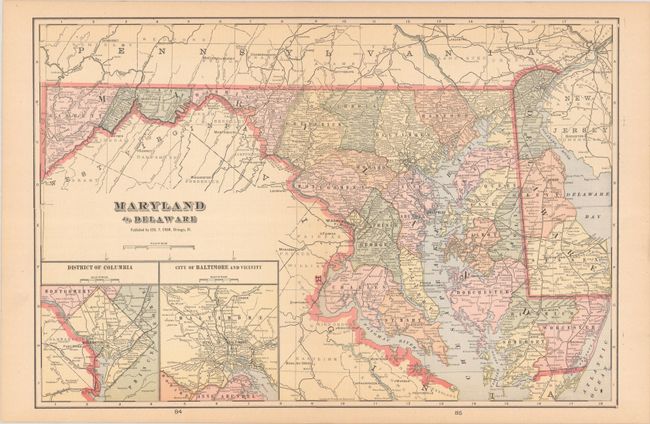
A. Maryland and Delaware, by George F. Cram, circa 1905 (20.2 x 13.5"). This handsome atlas map shows towns, cities, counties, and railroads, with a neighboring counties in Virginia, Pennsylvania, and New Jersey identified as well. Two insets appear at bottom right: District of Columbia and City of Baltimore and Vicinity.
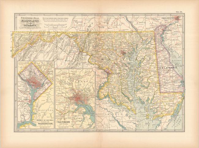
B. The Century Atlas. Maryland and Delaware, by the Century Co., from The Century Atlas of the World, dated 1897 (15.4 x 10.6"). This detailed map extends as far south as Richmond and as far north as Philadelphia, but most of the information is concentrated on Maryland and Delaware. Railroads are delineated with red lines. Insets at bottom left depict Washington, D.C. and Baltimore in small, intricate plan form. Printed by Matthews-Northrup Co.
References:
Condition: A
Minor toning.