"Petit Atlas Moderne ou Collection de Cartes Elementaire...", Delamarche, Francois Alexander
Subject: Atlases
Period: 1793 (circa)
Publication:
Color: Hand Color
Size:
6.5 x 9 inches
16.5 x 22.9 cm
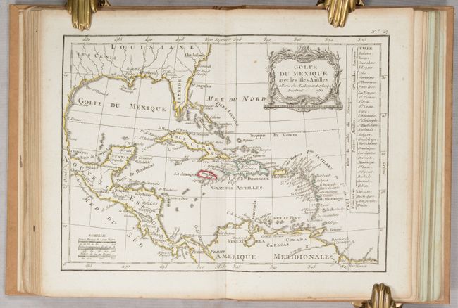
This is an early school atlas complete with 29 plates: frontispiece, 2 uncolored celestial charts, and 26 crisply engraved, double-page maps. The maps include the world and 5 continents, 12 regional maps of Europe, 2 regional maps of Asia, 2 regional maps of Africa, United States, Gulf of Mexico, and two biblical maps. The maps are nicely detailed with cities, topography, and watershed, and are decorated with rococo-style cartouches. Most of the maps include a table of place names broken down by region. Several maps are of particular interest:
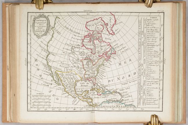
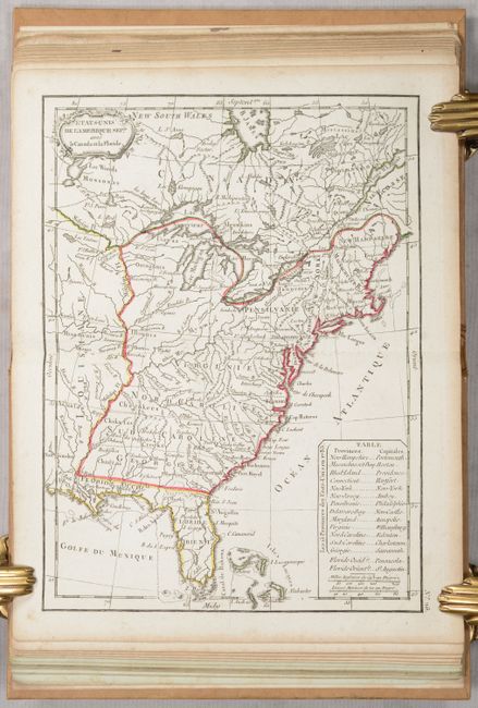
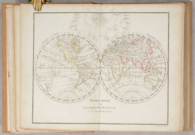
The double-hemisphere world map has sparse interior detail and shows the track of Captain Cook's third voyage. The map of North America shows the new United States extending to the Mississippi. West of the Mississippi is a large Louisiana Territory and Nouveau Mexique. Santa Fe is named in the west, and Cenis appears in Mexico. The entire Northwest is blank with the exception of a couple of rivers and a notation that the coast was discovered by Russians. There is a table at right that identifies the thirteen states, the remaining possessions of the French, English and Spanish, and tribes on the continent. The map of the young United States depicts Virginia, North Carolina, South Carolina, and Georgia extending to the Mississippi River, and numerous forts and Indian villages are also located. A table in the Atlantic names the 13 states with their capitals.
The charming frontispiece features a cherub with a variety of scientific instruments. 34 pages of text follows the maps. Hardbound in contemporary tan paper covered boards with title embossed on spine.
References:
Condition: B+
The maps have contemporary outline color with minor toning, soiling, and occasional foxing. The double-page map of France has a 1" tear near the center. The large folding map of France has a 3" binding tear and several fold separations that have been archivally repaired on recto, and the map has been rebound into the volume with a new guard. The text is on bluish paper with very light soiling. The frontispiece and table of contents has moderate foxing and soiling. The new covers are in near perfect condition except for a small stain along the spine at top.