"[Western Hemisphere - A Correct Sea Chart of the Whole World, According to Wright's Commonly Called Mercator's Projection]", Halley, Edmund
Subject: Western Hemisphere - America
Period: 1728 (published)
Publication: Atlas Maritimus & Commercialis
Color: Hand Color
Size:
27.1 x 22.3 inches
68.8 x 56.6 cm
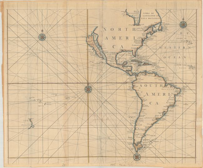
This sea chart depicts the Western Hemisphere of the four-sheet world map A Correct Sea Chart of the Whole World..., for which the title cartouche resides on the Eastern Hemisphere sheet. The chart depicts the Island of California, with the northwest coast of North America indented before trailing off. The interiors of North and South America are not delineated, with place names focused on the coasts. The Falkland Islands are only partially delineated, and the western coast of New Zealand is shown in the south Pacific. Published by J. & J. Knapton and John Senex. The sheet stands well on its own and is decorated with three compass roses. On two sheets, joined.
References: McLaughlin #207; Shirley (BL Atlases) #M.HALL-1a, #1; Wagner, H. (NW) #532.
Condition: B
Issued folding with several fold separations and four 1-2" tears that have been all been closed on verso with non-archival materials. There is some light staining visible on recto from the repairs made on verso and some minor creasing along the joint at lower center.