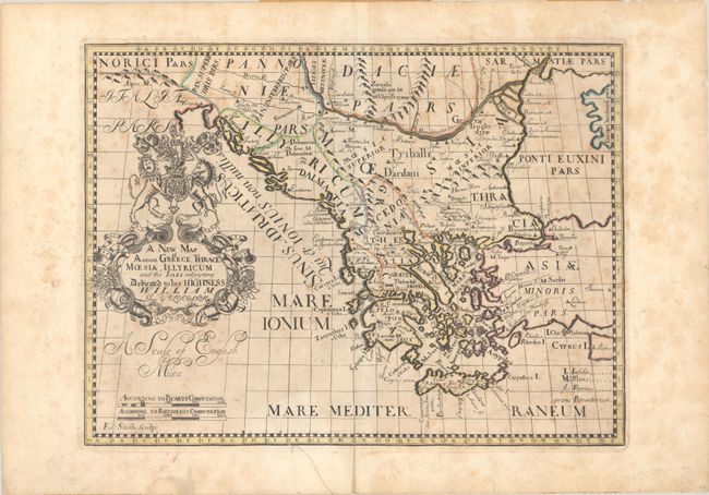
"A New Map of Antient Greece, Thrace, Moesia, Illyricum, and the Isles Adjoyning Dedicated to His Highness William Duke of Glocester", Wells, Edward
Subject: Balkans
Period: 1701 (circa)
Publication: A New Sett of Maps both of Antient and Present Geography
Color: Hand Color
Size:
19.3 x 14.4 inches
49 x 36.6 cm
This English map of the present-day Balkans is filled with ancient place names and political boundaries, extending from as far as the Alps east to Turkey, Cyprus and the Black Sea. A key at lower right identifies islands, mountains, and rivers. The elaborate title cartouche prominently features the coat of arms of the Duke of Gloucester and the title includes a dedication to Prince William. Engraved by Edward Smith.
References: Shirley (BL Atlases) T.WELL-1a #18.
Condition: B
A dark impression with moderate foxing and an archivally repaired edge tear at bottom that extends 1" into the image. A short centerfold separation confined to the bottom blank margin and several other small edge tears have also been repaired with archival materials on verso. There are remnants of masking tape along the sheet edges on verso from a previous framing.