Catalog Archive
Auction 195, Lot 610

"T Koninkryk Hongarien Zevenbergen Moldavie Wallachyen Slavonie en Croatien en de Aangrensende Ryken...", Keizer/De Lat

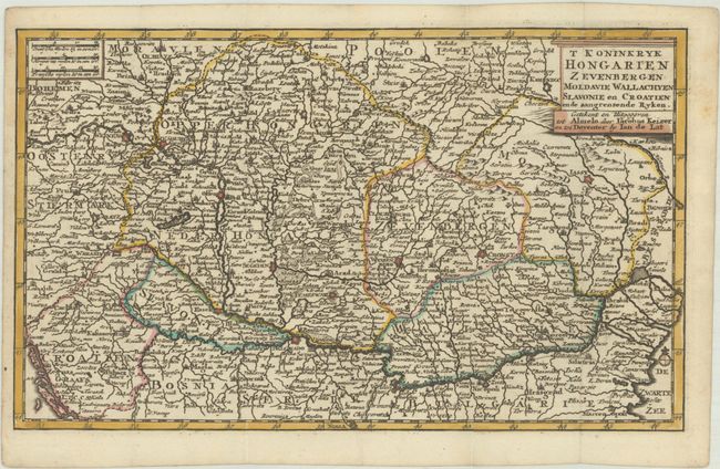
Subject: Southeastern Europe, Hungary

Period: 1747 (circa)

Publication:

Color: Hand Color

Size:
11.5 x 6.9 inches
29.2 x 17.5 cm
Download High Resolution Image
(or just click on image to launch the Zoom viewer)

A densely engraved map of the Kingdom of Hungary showing topography, cities, towns, and the river systems, with the Danube River running prominently across the map. The map extends from Enns, Austria and the Dalmatian Coast in the west to Kiliya, Ukraine and the Black Sea in the east. Adorned with a plinth-style title cartouche.

References:

Condition: A

A sharp impression with contemporary outline color and later color in the cartouche, issued folding on a bright, watermarked sheet. There is minor foxing in the blank margins and a narrow left margin, as issued.

Estimate: $110 - $140

Sold for: $80

Closed on 11/15/2023

Archived