Catalog Archive
Auction 195, Lot 545

"Mapa del Reyno de Navarra Comprehende las Merindades de Pamplona, Estella, Tudela, Sanguessa, Olite, Cuidades, Villas, Valles, y Cendeas &c...", Lopez, D. Tomas

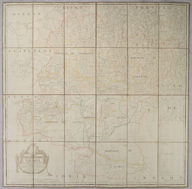
Subject: Northern Spain

Period: 1772 (dated)

Publication:

Color: Hand Color

Size:
30.7 x 30.7 inches
78 x 78 cm
Download High Resolution Image
(or just click on image to launch the Zoom viewer)

This detailed map of the Navarra province in northern Spain is filled with cities, towns, villages, administrative boundaries, landmarks, public buildings, roads, rivers, canals, forests and mountains. An extensive legend is at bottom right. The prime meridian is Tenerife. Originally printed on four sheets, this map has been dissected and mounted on linen.

References:

Condition: B+

A light impression with contemporary outline color, a bit of soiling, and some small dampstains. There are some small holes in the linen along the folds.

Estimate: $350 - $425

Unsold

Closed on 11/15/2023

Archived