"Bacon's Picture Map of London", Bacon, G. W. & Company
Subject: London, England
Period: 1908 (circa)
Publication:
Color: Printed Color
Size:
36.3 x 23.3 inches
92.2 x 59.2 cm
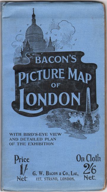
This lovely edition of G.W. Bacon & Company's pictorial map of London was published to capitalize on the influx of visitors to the city during the Franco-British Exhibition and the Summer Olympics of 1908. The fair grounds and Olympic stadium are pictured at left, and the accompanying 62-page booklet, Strangers' Guide to London, includes a bird's-eye illustration of the exhibition and a plan of the grounds. The beautifully illustrated and informative map identifies streets, electric railways, parks, theaters and music halls, and more. Small illustrations of notable locations pepper the landscape. The border features 19 small views, including the Albert Memorial, Waltham Abbey, Victoria Park, Tower Bridge, the Thames from Richmond, and Windsor Castle. Keys in the bottom corners located principal buildings, hotels, leading business houses, and theaters. The guide to London includes plenty of useful information for tourists and two additional black & white maps: Large-Scale Map of Central London and London and Suburban Railway Stations. Folds into blue illustrated covers (4.5 x 8.2").
References:
Condition: B+
Issued folding with a few short separations and a manuscript notation by the exhibition grounds. There is minor wear to the wrappers.