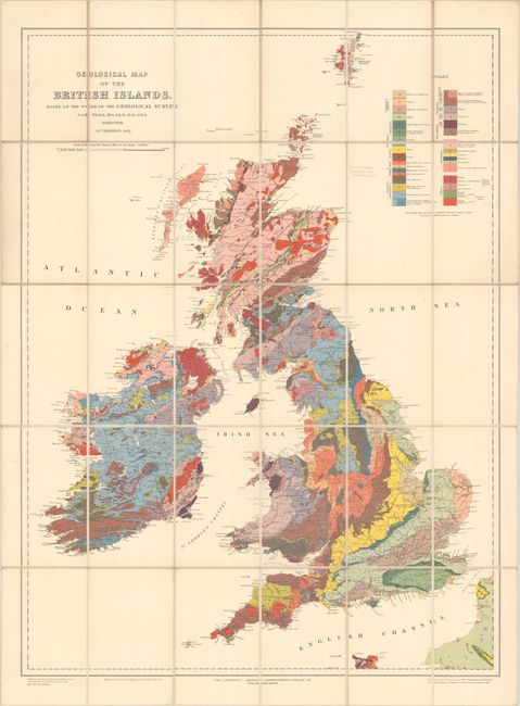
"Geological Map of the British Islands. Based on the Work of the Geological Survey", British Ordnance Survey
Subject: Britain
Period: 1924 (dated)
Publication:
Color: Printed Color
Size:
24.3 x 32.6 inches
61.7 x 82.8 cm
This attractive and highly colorful map of the British Isles describes the geology using 28 different units. In addition to the impressive geological detail, towns, roads and rivers are displayed. Drawn at a scale of 25 miles per inch. Produced under the direction of J.J. H. Teall, Director of the Geological Survey. The map is dissected and backed with linen and folds into self-wrappers with printed cover.
References:
Condition: A
Clean and bright with very minor soiling. There is an old pencil notation adjacent to the legend. There is an old bookseller's label on the front cover, as well as some pencil notations and an erasure.