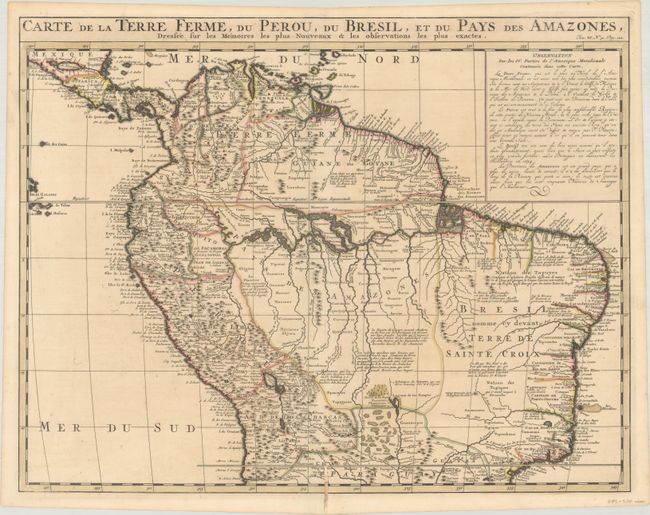
"Carte de la Terre Ferme, du Perou, du Bresil, et du Pays des Amazones, Dressee sur les Memoires les Plus Nouveaux & les Observations les Plus Exactes", Chatelain, Henry Abraham
Subject: Northern South America
Period: 1720 (circa)
Publication: Atlas Historique...
Color: Hand Color
Size:
20.5 x 15.9 inches
52.1 x 40.4 cm
Handsome map of the northern part of South America based on the cartography of Guillaume Delisle. It is filled with place names and notations speculating about the Indian tribes and the tributaries of the Amazon. The Capitaineries are named in Brazil and the Inca Way (Grand chemin des Ingas) is shown from Chuquisaca in Peru to Pasto in Colombia. A notation in Guyana notes the mythical Lac de Parime on which the golden city of Manoa del Dorado was supposed to be located. The central part of the map (Pays des Amazones) is filled with Indian names.
References:
Condition: B+
A crisp impression on a sheet with a Strasbourg Bend & Lily watermark. There is a hint of toning in the image and a centerfold separation at bottom that extend 1.75" into the image has been closed on verso with archival materials.