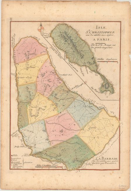
"[Lot of 2] Isle St. Christophle une des Antilles aux Anglois [on sheet with] La Barbade une des Antilles aux Anglois Divisee par Paroises [and] Carte de l'Isle de la Barbade...",
Subject: Barbados & St. Kitts
Period: 1750-58 (circa)
Publication:
Color: Hand Color
A. Isle St. Christophle une des Antilles aux Anglois [on sheet with] La Barbade une des Antilles aux Anglois Divisee par Paroises, by George Louis Le Rouge, circa 1750 (8.3 x 10.9"). This sheet features two small maps, one showing St. Kitts and the other showing Barbados. The map of Barbados delineates parish divisions. Rocks are noted around the islands by a small 'x'. The cities, churches, and other sites of interest are located by means of a key at the lower left. Reference: Tooley (MCC-81) #26. Condition: Contemporary color on a watermarked sheet with scattered foxing. (B+)
B. Carte de l'Isle de la Barbade, pour Servir a l'Histoire Generale des Voyages, by Jacques Nicolas Bellin, from Histoire Generale des Voyages, circa 1758 (5.9 x 7.8"). This small map of Barbados divides the island into eleven parishes with a well developed network of roads throughout. It is decorated by a strapwork title cartouche and fleur-de-lis. Condition: A crisp impression on a bright sheet with minor dampstains along the edges of the sheet. (A)
References:
Condition:
See description above.