"The World on Mercator's Projection", Bartholomew, John
Subject: World
Period: 1875 (circa)
Publication:
Color: Hand Color
Size:
25.9 x 20.1 inches
65.8 x 51.1 cm
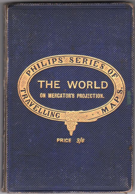
This handsome world map shows the "Supposed Antarctic Continent" taking shape, with spans of conjectural coastline between established discoveries, which are shown with dates and the names of explorers. Several territories are identified in the American West, including Dakota, Montana, Wyoming, Washington, Utah, Arizona, and New Mexico. In South America, Colombia is the United States of Colombia. In southern Africa, the Boer republics Trans Vaal Republic and Orange River Republic appear next to the northeast of Cape Colony. Sea routes with distances in nautical miles are delineated throughout the map. The appearance of Franz Jospeh Land in the Arctic Ocean with a date of 1874 indicates a publication date of circa 1875. Published by George Philip & Son, part of "Philips' Series of Travelling Maps." The map is dissected and mounted on linen, as issued. Folds into dark blue pebbled cloth-covered boards (4.6 x 6.7") with gilt decoration and title on cover.
References:
Condition: B
Dissected, mounted on linen, and folding, as issued. There is light soiling and foxing and a couple of small splits in the linen at the fold intersections. Covers have minor soiling and light edge wear.