"Cote Nord-Ouest de l'Amerique Reconnue par le Cape. Vancouver. VIe. Partie...", Vancouver, George (Capt)
Subject: Southern Alaska
Period: 1799 (circa)
Publication: Vancouver's Voyages (French Edition)
Color: Black & White
Size:
27.8 x 21.3 inches
70.6 x 54.1 cm
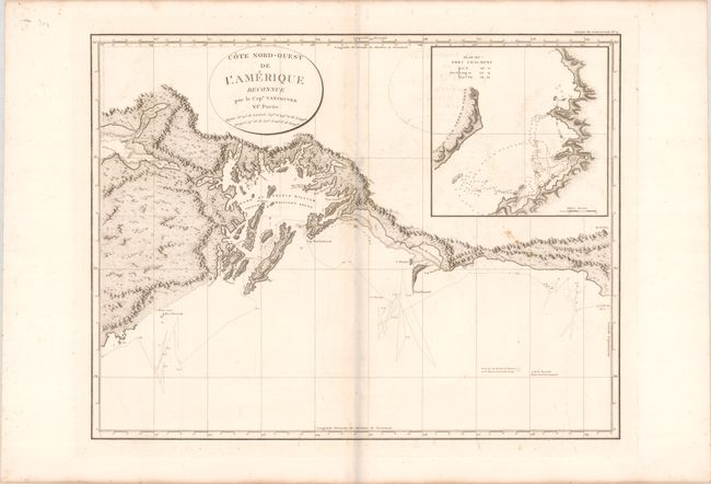
This is the French edition of an important, large-scale chart presenting the Alaskan coast from Mt. St. Elias in the east to Prince William Sound and the eastern side of the Kenai Peninsula in the west. It features good detail of the mountainous interior and numerous offshore islands. The track of Vancouver's route is shown zigzagging throughout the region and is coupled with detail of the coastlines, soundings, shoals, and bottom types. Features an inset of Port Chalmers at top right.
During the summers of 1792-94, George Vancouver and the crew of the British naval ships Discovery and Chatham mapped the western coast of North America from Baja California to Alaska. Vancouver's voyage was the last, and longest, of the great Pacific voyages of the late eighteenth century. Taking the art and technique of distant voyaging to a new level, Vancouver eliminated the possibility of a Northwest Passage, and his remarkably precise surveys completed the outline of the Pacific.
References: Phillips (Atlases) #1219; cf. Wagner #858.
Condition: B+
A crisp impression on watermarked paper with light foxing and offsetting. Folded by a previous owner with a soft horizontal crease.