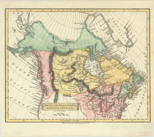
"British Dominions in North America", Russell, John C.
Subject: Northern United States & Canada
Period: 1814 (dated)
Publication:
Color: Hand Color
Size:
8.9 x 7 inches
22.6 x 17.8 cm
An attractive small map covering Canada and the northeastern United States. It is hand-colored to show various political divisions (though the U.S. is included in the color scheme) along with good detail of watersheds and topography. In the west the provinces of New Georgia, New Hanover, New Cornwall and New Norfolk stretch between Alaska and New Albion. On this map, the British mapmaker claims the northwest region to the Columbia River for Britain. In the Arctic, notations indicate "The Sea seen by" Hearn (1771) and MacKenzie (1789). Drawn and engraved by J. Russell, and published by Nutthall, Fisher & Dixon, Liverpool, July 1, 1814.
References:
Condition: A
A crisp impression on a bright sheet with a few faint spots.