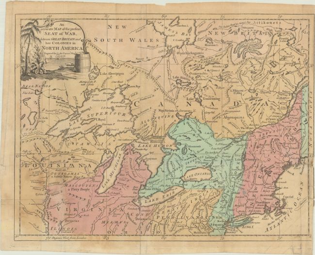
"An Accurate Map of the Present Seat of War, Between Great-Britain and Her Colonies in North America",
Subject: Colonial Great Lakes
Period: 1776 (dated)
Publication: Universal Magazine
Color: Hand Color
Size:
13.6 x 10.3 inches
34.5 x 26.2 cm
This uncommon map of the Great Lakes region was included in the October 1776 issue of Universal Magazine, published only three months after the signing of the Declaration of Independence. The map extends from the St. Lawrence River south to Philadelphia and west to beyond the Mississippi River. It is filled with details including settlements, forts, Indian villages, mountains, the river systems, and more. Several mythical islands appear in Lake Superior including Minong I. and Pontchartrain I. Lower Michigan is askew, and much of the northern part is noted as “Elevated Land.” Notations to the west of Lake Michigan include “Mascoutens – a Fiery People” and “Outagamis – a Subtle Nation.”
References: Jolly #UNIV-176; Kershaw #979.
Condition: B
Issued folding on watermarked paper with some light staining at lower left. A few short fold separations and a 1.5" edge tear at right have all been closed on verso with non-archival tape.