NO RESERVE
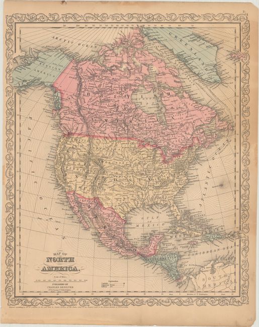
"Map of North America", Desilver, Charles
Subject: North America
Period: 1856 (dated)
Publication: A New Universal Atlas...
Color: Hand Color
Size:
13.1 x 15.7 inches
33.3 x 39.9 cm
A fine steel-engraved map with evolving western territorial borders. Washington and Oregon territories extend to the Continental Divide, while Utah and New Mexico territories are in their largest extent. Above Texas is Indian Territory, Kansas Territory, and a huge Nebraska Territory stretching from the Rocky Mountains to the Missouri River. There is good detail throughout including Mexico, Central America and British America. Alaska is Russian America. Surrounded be a decorative scrollwork border.
References:
Condition: B+
There is some light staining along the right border and a few small edge tears that have been closed on verso with archival tape. Remnants of cello tape along the sheet edges are far from the image.