"[Lot of 2] North America [and] North America",
Subject: North America
Period: 1806-34 (circa)
Publication:
Color: Black & White
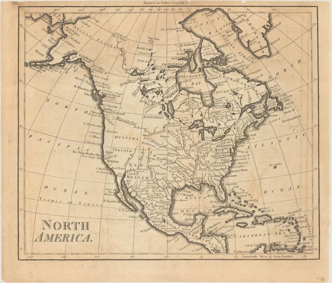
A. North America, by John Walker, from Walker's Geography &c., circa 1806 (8.8 x 7.4"). This attractive map of North America shows the United States confined to east of the Mississippi River with East & West Florida to its south. Louisiana stretches from the Mississippi River west to the Rocky Mountains, and Spain is in control of the western United States. A River of the West is connected to a series of tributaries, suggesting a possible Northwest Passage. To the north, Alaska is taking shape with a few islands shown at the end of the Aleutian Peninsula. Condition: Issued folding with light offsetting and some dampstaining at top. (B)
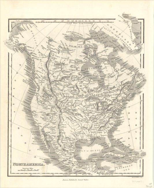
B. North America, by Samuel Walker, circa 1834 (8.4 x 9.6"). This copper engraved map shows good detail of the interior river systems along with numerous Indian tribes. Knowledge west of the Rocky Mountains is limited, with L. Trimpanogos carrying a "doubtful" notation and the Great Salt Lake whose western limits "are unknown." Engraved by Illman & Pilbrow. Condition: A crisp impression on a bright sheet with a bit of soiling below the title. (A)
References:
Condition:
See description above.