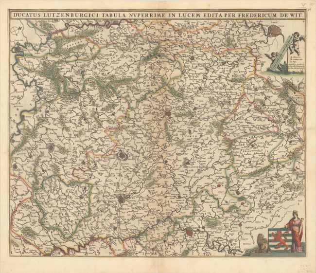
"Ducatus Lutzenburgici Tabula Nuperrime in Lucem Edita", Wit, Frederick de
Subject: Luxembourg
Period: 1671 (circa)
Publication:
Color: Hand Color
Size:
21.8 x 18.3 inches
55.4 x 46.5 cm
A detailed map covering the region around Luxembourg, extending north to Liege, Belgium, west to the Champagne region of France, and east to include a small portion of Germany. Locates the cities of Metz, Trier, Arlon and Charleville-Mezieres. The map is filled with good detail of fortified cities, towns, rivers, forests, and more. North is oriented to the top right corner. Decorated by Luxembourg's coat of arms at bottom right and a pair of putti holding up two distance scales. This is the third state, with street plans engraved in the cities, published 1671-76. Blank verso.
References: Carhart #143.3.
Condition: B+
A dark impression with full contemporary color, light toning along the centerfold, and a centerfold separation at bottom.