Catalog Archive
Auction 194, Lot 426

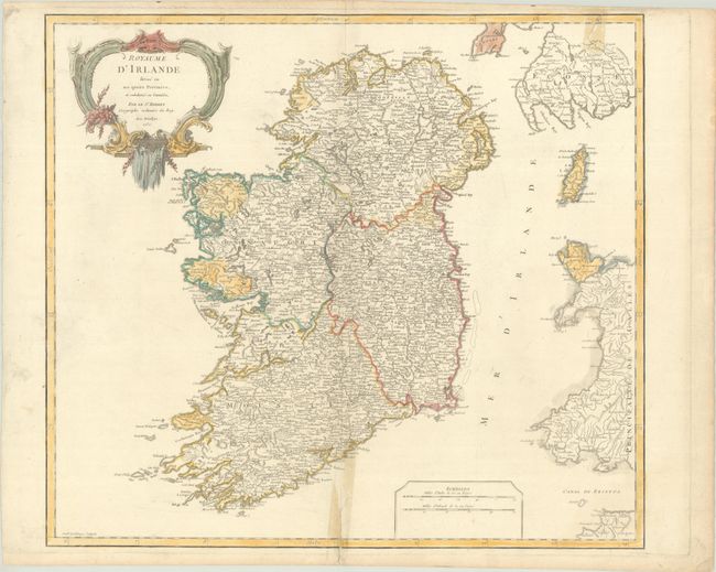
"Royaume d'Irlande Divise en ses Quatre Provinces, et Subdivise en Comtes", Robert de Vaugondy, Gilles

Subject: Ireland

Period: 1750 (dated)

Publication: Atlas Universal

Color: Hand Color

Size:
21.7 x 19.4 inches
55.1 x 49.3 cm
Download High Resolution Image
(or just click on image to launch the Zoom viewer)

An attractive and detailed map of Ireland divided into the counties of Ulster, Leinster, Munster and Connacht. It is densely engraved with numerous towns and villages, castles, rivers, lakes, mountains, and more. The map extends to include the western coast of Wales, Scotland, and the Isle of Man. Features two distance scales at bottom and decorated by a rococo title cartouche.

References: Pedley #56.

Condition: B

A bright sheet with a Society of Jesus watermark. A short tear at top right and and a centerfold separation at bottom have been repaired on verso with cello tape, causing tape stains on recto.

Estimate: $160 - $190

Sold for: $120

Closed on 9/13/2023

Archived