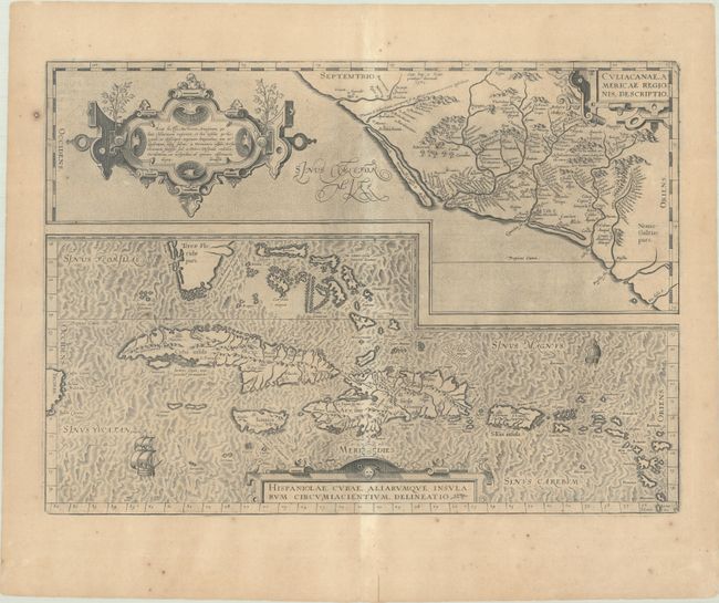
"Culiacanae, Americae Regionis, Descriptio [on sheet with] Hispanoliae, Cubae, Aliarumque Insularum Circumiacientium, Delineato", Ortelius, Abraham
Subject: Caribbean & Mexico
Period: 1603 (published)
Publication: Theatrum Orbis Terrarum
Color: Black & White
Size:
19.6 x 14.1 inches
49.8 x 35.8 cm
Two great early maps of important regions in the New World are combined into this interesting composition. The first covers the region of western Mexico around Culiacan and the Spanish settlement of Villa S. Michael's, the region noted for its silver mines. The second is the first detailed map of the Greater Antilles with detail in southern Florida, the Bahamas, and the Caribbean that is quite remarkable for the period. Ortelius based the maps on a variety of sources including Mercator’s world map (1569) and other maps by Guttierez and Alonso De Santa Cruz. Three strapwork cartouches and sailing ships decorate the map. Latin text on verso.
References: Van den Broecke #14.
Condition: B+
A nice impression on a sheet with light toning except for the centerfold and a few spots of foxing. There is a centerfold separation in the bottom blank margin that has been closed on verso with archival tape.