"[Lot of 2] Map of the Northern Part of the State of Maine and of the Adjacent British Provinces... [and] Extract from a Map of the British & French Dominions in North America", U.S. Government
Subject: Maine
Period: 1838 (published)
Publication: Sen. Doc. 319, 25th Congress, 2nd Session
Color:
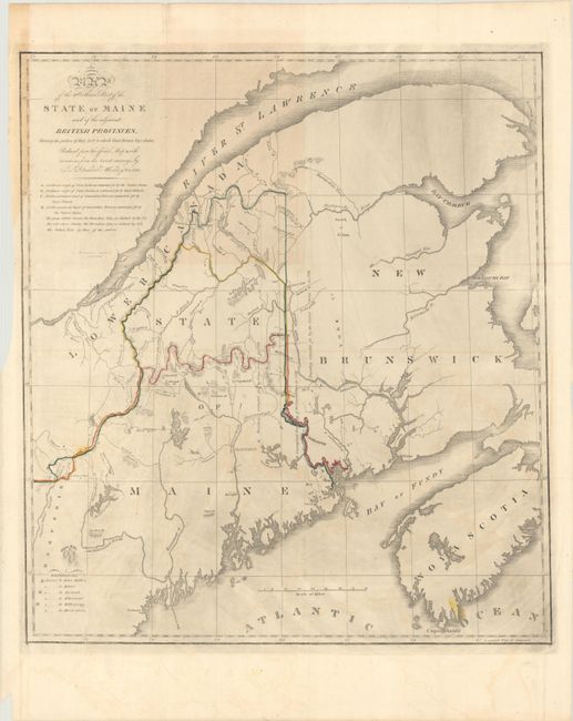
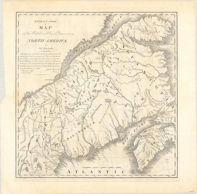
The first map details the boundary dispute between the United States and Great Britain relating to Maine. Hand coloring is used to show the boundary as claimed by the United States and by Great Britain, with a third line labeled "that of the Arbiter" which closely corresponds to Maine's present-day border with Canada. A table gives the major points of contention in this border dispute. Another table names land grants belonging to six land holders. The second map is in black and white and was included for historical purposes. It was extracted from Mitchell's map of 1755 by W.J. Stone.
A. Map of the Northern Part of the State of Maine and of the Adjacent British Provinces, Shewing the Portion of That State to Which Great Britain Lays Claim..., by S.L. Dashiell, dated 1830, hand color (15.4 x 17.4"). Condition: There is minor offsetting, light toning at upper left, and some printer's ink residue. A short fold separation at top has been closed on verso with archival tape.
B. Extract from a Map of the British and French Dominions in North America by Jno. Mitchell, black & white (13.2 x 13.5"). Condition: On a bright sheet with a few light stains.
References: Claussen & Friis #219 & #220; Phillips (M) p. 384.
Condition: B+
Issued folding. See description above.